Darién
A stretch of jungle between Yaviza and Colombia where the Pan-American Highway ends, the Darién is navigated by dugout canoe through Emberá villages and the mangroves of the Gulf of San Miguel.
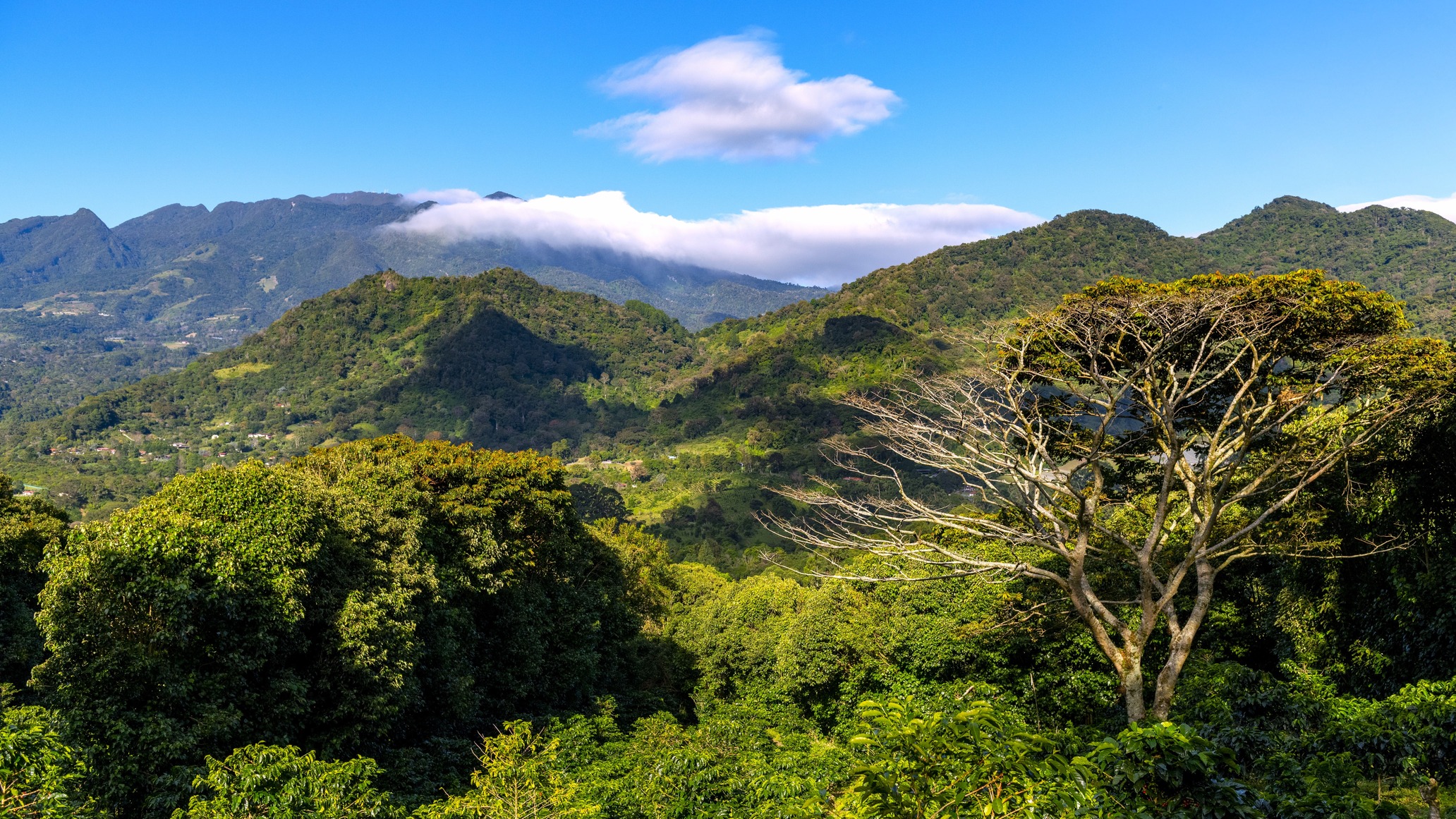
The Darién spans 16,800 km² in the country's east, bordering Colombia. It's the only break in the Pan-American Highway across its 30,000-kilometre span connecting Alaska to Patagonia: the road simply stops at Yaviza, and beyond lies a tangle of humid forest, mangroves, brown rivers and marshes. This discontinuity, the infamous Darién Gap, is not a logistical accident but a deliberate political and ecological choice since the 1970s, designed to preserve the jungle and contain foot-and-mouth disease.
Darién National Park, established in 1980 and inscribed on the UNESCO World Heritage list in 1981, protects 5,790 km² of it. Our team conducts travellers through the park primarily via the Sambú, Tuira and Chucunaque rivers, navigated in piraguas—long motorised dugout canoes carved from a single ceiba or espavé trunk. From the Punta Patiño base on the Gulf of San Miguel, you observe troops of howler and capuchin monkeys in the dry season, spectacled caimans on the riverbanks, and with patience, the harpy eagle, a two-metre-wingspan raptor that nests in the emergent cuipo trees.
Three peoples share the territory. The Emberá and Wounaan, who migrated from the Colombian Chocó several centuries ago, live in communities of 100 to 300 inhabitants along the waterways, in stilt houses called tambos. Men still hunt with rifles and blowguns; women weave chunga fibre into fine baskets and tattoo with jagua, a black plant dye that fades in two weeks. The Guna occupy the Madungandí region to the north. The rest of the population, mestizo and Afro-descendant, concentrates in the towns of La Palma, the provincial capital with coloured wooden houses overlooking the bay; El Real de Santa María, a former colonial trading post; and Garachiné on the Pacific coast.
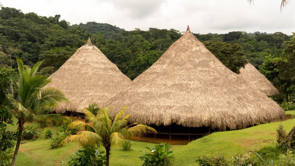
Our agency has partnered for several years with two Emberá communities in the Sambú basin, welcoming travellers in limited numbers in traditional palm-thatched wagara cabins. Meals depend on what the river and forest provide that day: fried plantain patacones, grilled catfish, culantro coriander chicken sancocho, pifa palm fruits cooked in salt water. There is no permanent electricity, and mobile networks fail well before arrival.
The Darién is not a region you pass through; it's a region you enter slowly. Rhythm is dictated by the tides, which uncover and recover the red mangrove swamps twice daily, and by light, which falls vertically at six in the evening. It's also a sensitive zone: the Colombian border has been crossed by significant migrant flows since 2021, and certain eastern valleys remain closed to tourism. We operate exclusively in sectors authorised by SENAFRONT and the environment ministry, with accredited local guides.
Highlights
Canoe trip on the Sambú. Navigate upriver from Garachiné to the Emberá villages of Pavarando or Puerto Indio, six to eight hours of travel through mangrove that gradually transforms into primary forest.
Punta Patiño and the harpy eagle. Private reserve of 30,000 hectares managed by ANCON, one of the few places where the harpy eagle, Panama's national symbol, can be observed with reasonable probability between January and March.
Stay in an Emberá community. Two to three nights in a stilt tambo, shared meals, blowgun demonstrations, chunga fibre basket-weaving and jagua tattoos applied by village women.
La Palma, river capital. Town of 4,000 with no road access, reachable only by boat from Puerto Quimba or by air taxi. Essential departure point for the Gulf of San Miguel.
El Real and Balboa's route. Former 16th-century colonial fort where gold from Cana was shipped to Panama Viejo. This is also where Balboa crossed the isthmus in 1513 to reach the Pacific.
When to go
The Darién is the country's wettest region, receiving 3,000 to 4,500 mm of annual rainfall depending on the valleys. The dry season, from late December to early April, remains the main working window: rivers are safely navigable, forest trails passable, and wildlife viewing significantly better as fauna concentrates near water sources. Temperatures range from 24 to 32 °C, with humidity around 80%.
From April to September, showers are daily but often brief, typically late afternoon, leaving mornings explorable. We strongly advise against October and November: rainfall becomes continuous, the Tuira and Chucunaque rivers regularly overflow, certain villages are cut off for days, and park trails become impassable. Our circuits close during these two months.
Practical advice
The Darién requires a minimum of four days on-site, ideally five to seven, to justify access logistics. Entry is by air taxi from Albrook (Panama City) to La Palma or Bahía Piña, a 45-minute flight, or by 4x4 to Puerto Quimba (5 hours from the capital) then by lancha. Independent travel is impossible: a named permit from the environment ministry and an accredited guide are mandatory, and our agency handles both procedures.
The region combines well with Panama City and the Canal at the start or end of your itinerary for logistical reasons. It pairs poorly with Bocas del Toro or Chiriquí on trips under three weeks due to distances and comfort contrasts. The Darién appeals to independent travellers curious about forest societies, comfortable with humidity, insects, no permanent electricity and basic sanitation. It's not suitable for families with children under 10, nor for classic contemplative travel: it's a demanding immersion into a living, inhabited environment.